
Your knowledge, data and tools
Connect the documents, catalogues, files, APIs and professional software the team chooses.
Coding workspace for spatial teams
We build and deploy a coding workspace for developers and analysts. It connects the AI to the spatial data and tools chosen for the job, runs code in an isolated environment and keeps the files, maps and session history together.
Invited demonstration. Request a session before opening the workspace.
Made forDevelopers and spatial analysts who want AI to use geospatial code and tools while keeping the work visible and reviewable.
Demonstrated workflowSentinel-2 imagery → vegetation index → source-linked map
Latest operator check13 September 2026
Observed run · 13 September 2026
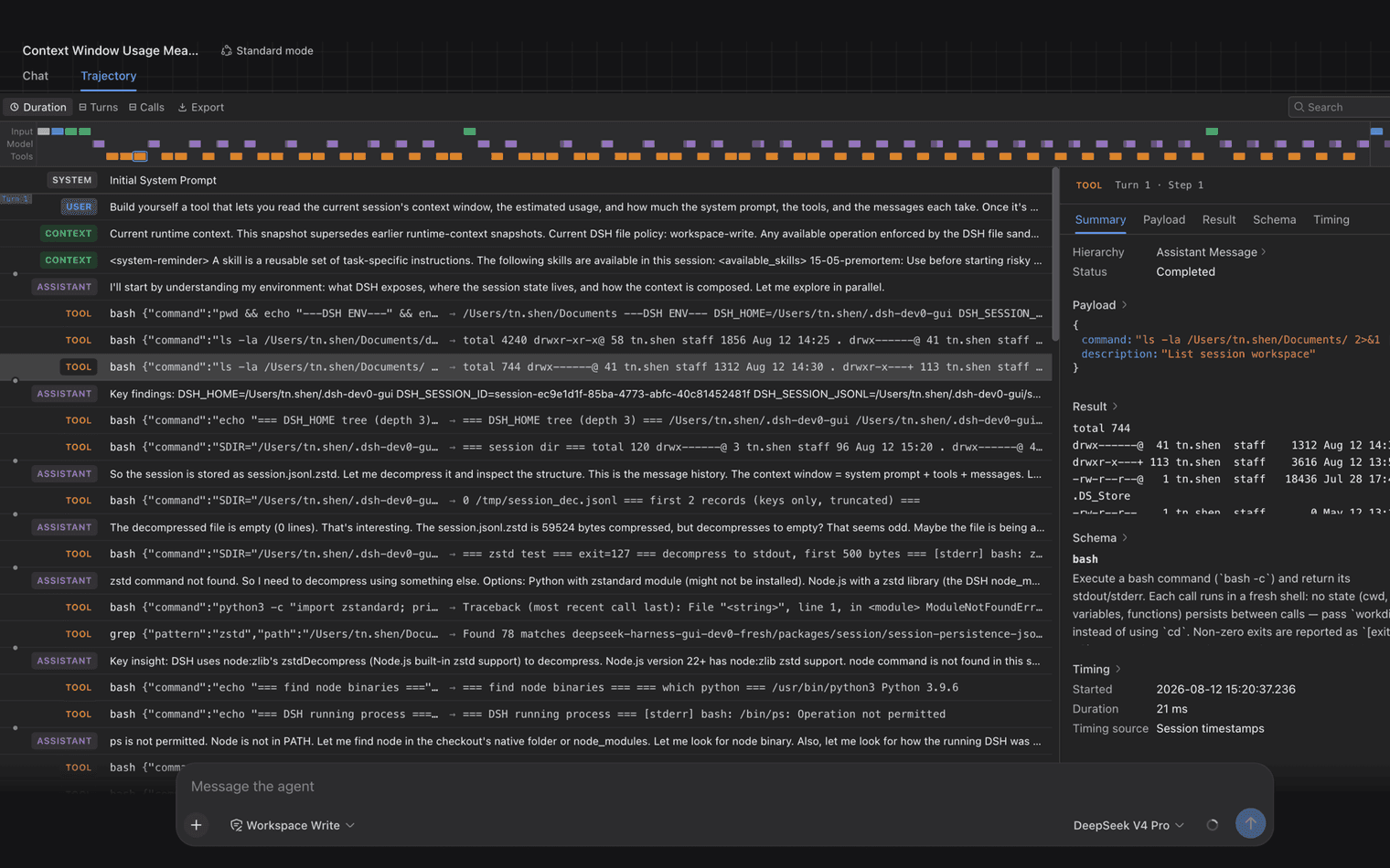
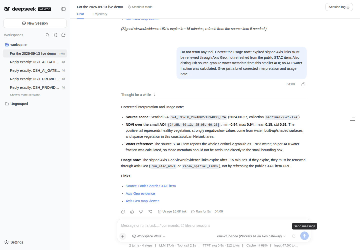
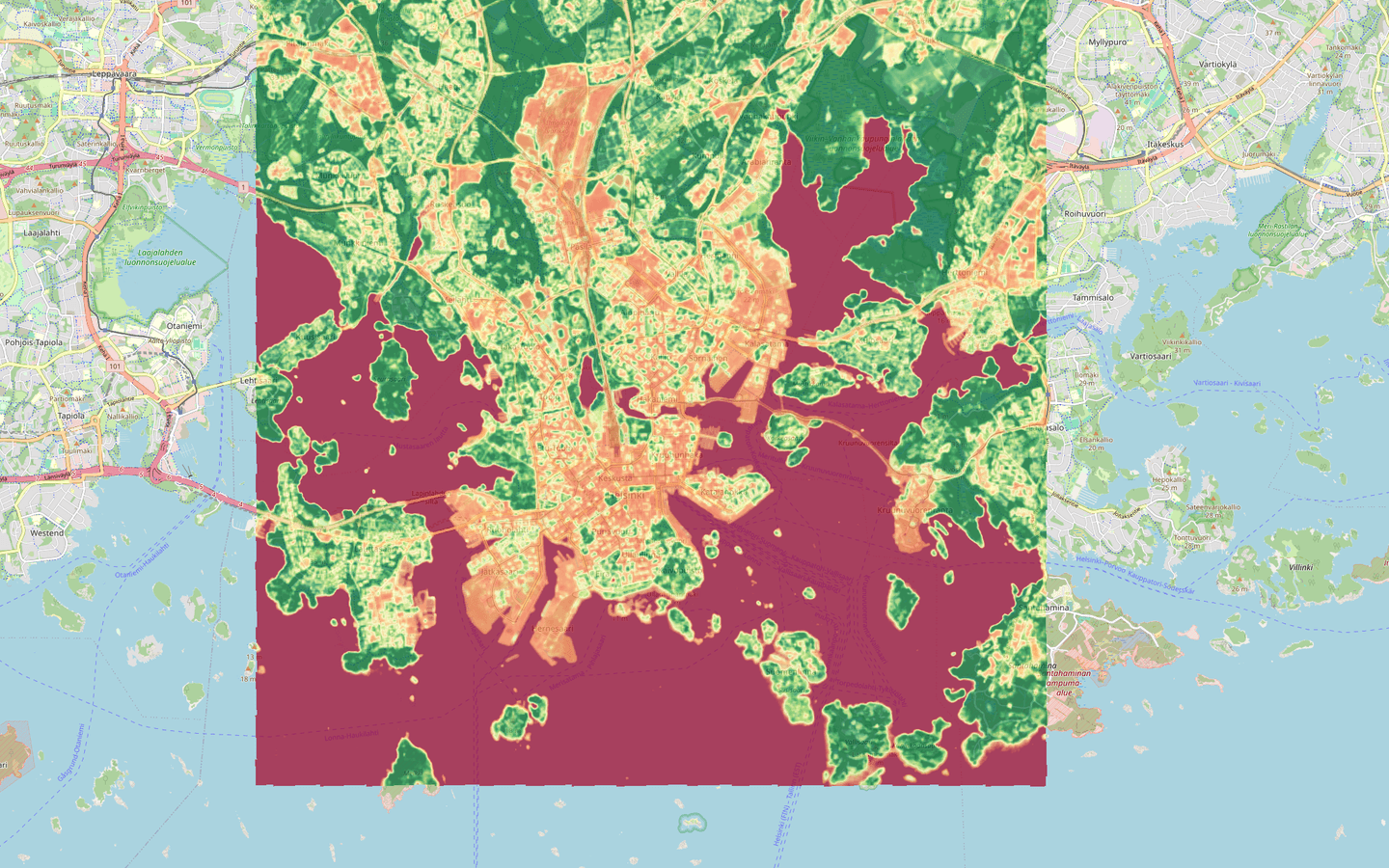
The captured DeepSeek Harness session shows the request, tool activity and corrected interpretation. Beside it, this website preview shows the resulting raster over a basemap.
The workflow
Set the area, date range, allowed sources and output the team needs.
Connect the selected data and spatial tools to isolated compute with clear limits and visible actions.
Open the source, files and map, review the result and save the session so the work can continue later.
What Axis Spatial adds
Built from the open-source DeepSeek Harness workspace and its composable plugin system, then specialised and deployed by Axis Spatial for geospatial tasks. We design the connections, execution, saved work and checks to preserve the meaning of the spatial data throughout the workflow.
We carry the place, date, source and coordinate system through the workflow and check what each output represents.
Connect the documents, catalogues, files, APIs and professional software the team chooses.
Run spatial code and tools in an isolated environment with agreed limits.
Save sessions, files and checkpoints so people can inspect the work and continue it later.
Check inputs, actions and outputs against the agreed requirements. Keep the sources and results available for review.
Observed in this demonstrationProtected deployed workspace, Axis Geo tool connection, Element 84 STAC source, isolated raster processing, stored output, signed map viewer and restored R2-backed session checkpoint.
Built for the organisationWe set up the access, connections, compute, saved work and review process around the team and the job.
Observed · 13 September 2026
Stock workspace entry, a restored session list, a real STAC tool result, source opening and rendered-map opening worked. A subsequent checkpoint was confirmed.
The initial explanation mixed whole-scene water metadata with the smaller analysis area and gave incorrect link-renewal advice. Both were corrected in a follow-up turn. We agree the checks and review points with the team and build them into the work.
This was an operator check of the hosted demonstration. It does not establish continuous uptime, production readiness or completion of the wider acceptance programme.
The demonstration runs one session at a time. Request a time with us before opening the workspace.
For your organisation
Tell us which knowledge, data, software and working practices your team needs to bring together.