AGRITECH
Score our 350 soya co-operatives against the upcoming monsoon anomaly forecast and flag the 20 highest-risk co-ops with a one-page brief per site.
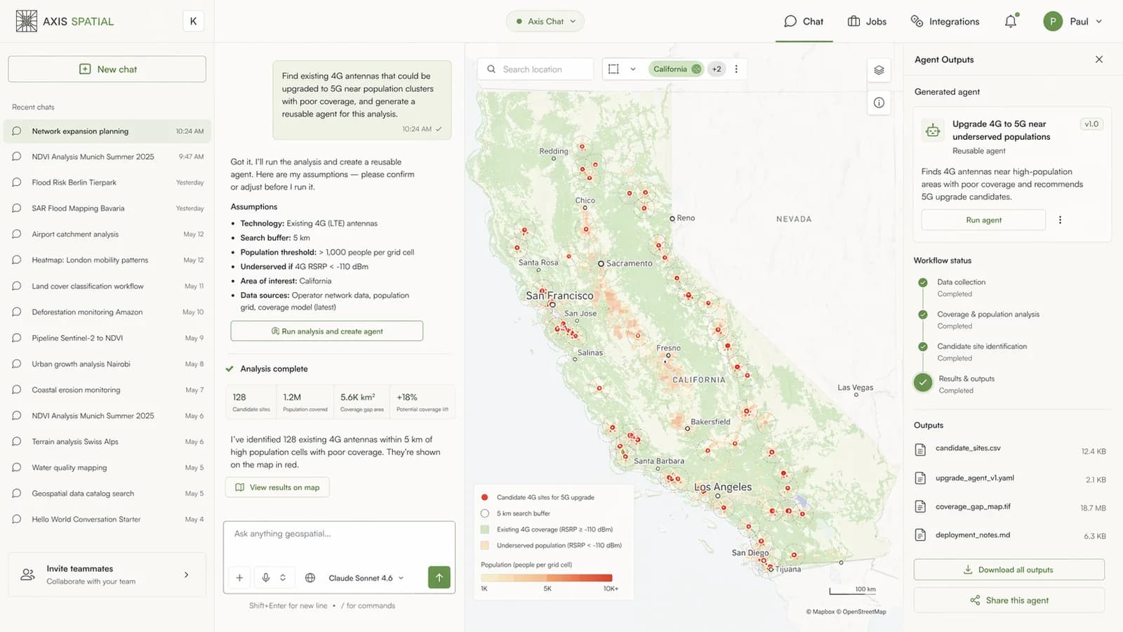
Chat is the front door to the Axis platform. Ask in plain language; the agent plans, executes, and returns a real artefact. When you want to save and repeat the work, one click turns any conversation into a reusable agent.
Practitioners ask in the language of their work. The agent picks the right data, the right tools, and returns a shareable artefact.
You type the question you would have emailed the GIS team. An answer you can share comes back the same afternoon, along with the code, the data it touched, and a button to run it again next quarter.- head of catastrophe modelling, European reinsurer
Type a sentence the way you would brief a colleague. No forms, no click-paths, no query builder. The agent parses intent and scopes the task before anything runs.
Before execution, the agent shows you the plan: which datasets, which tools, what the output will look like. Edit it inline, or approve and let it go.
A map, a file, a report, and the code that produced it. Save the whole conversation as a reusable agent, or call the same run via REST from your own product.
Any successful conversation saves as a named agent. Call it from your own product with a POST, pass the parameters your users supply, get the same artefact your team reviewed. Agritech apps, climate dashboards, and claims platforms embed Axis agents this way today.
Free to try. Sign in with email, ask anything geospatial, keep what you want to keep.

